Major oil deposits. Oil and gas fields in russia. Oil and gas regions of the Russian Federation
The West Siberian oil and gas province occupies the territory of the West Siberian lowland. The first gas field, Berezovskoye, was discovered in 1953.
The platform of the West Siberian province is located on the basement of the Paleozoic age, represented by sandy-giny Meso-Cenozoic deposits, the thickness of which reaches 4000-5000 m.
The West Siberian oil and gas province includes several oil and gas areas:
§ Sredneobskaya;
§ Vasyugan;
§ Frolovskaya;
§ North Tyumen;
§ Berezovo-Shaimskaya.
Sredneobskaya oil and gas region is represented by the Samotlor field, which is unique in terms of oil reserves. The richest oil fields also include Mamontovskoye, Sovetskoye, Ust-Balykskoye, Pravdinskoye, Zapadno-Surgutskoye.
Oil and gas content is established in the Tyumen, Vasyugan, Megion and Vartovskaya formations. The main oil reserves are associated with the deposits of the Vartovskaya and Upper Megionskaya formations. In their section, there are more than 30 permeable sandy strata, of which almost 20 with proven commercial oil and gas content. Significant accumulations of oil are enclosed in sandy and sandy-argillaceous formations of group "A" in the roof part of the Vartovskaya suite. Their thickness is variable and is often replaced by clays and siltstones.
At the base of the sedimentary cover lies the Tyumen Formation (Lower + Middle Jurassic) with a thickness of 200-300 m. It is expressed by alternating sandstones, siltstones, and clays. The Upper Jurassic within the Surgut and Nizhnevartovsk arches is represented by the Vasyugan and Georgievsk formations, consisting of alternating sandstones and mudstones with a thickness of 50-110 m.
The Megion and Vartovskaya formations (Valanginian and Hauteriv-Barremian) are composed of sandstone beds separated by mudstones with a thickness of 265-530 m.
Oil in the Middle Ob region has a density of 0.854-0.901 g / cm 3, a sulfur content of 0.8-1.9%. The highest sulfur content is in the oils of the Surgut region. All oils are low-paraffinic 1.9-5.3%.
North Tyumen oil and gas region includes more than ten fields, including the largest such as Urengoyskoye, Zapolyarnoye, Medvezhye.
The main features of the geological structure. The thickness of the sedimentary cover is more than 4000 m, but the lower part of the section has not been studied by drilling. The Lower-Middle Jurassic deposits are represented by alternating sandstones, siltstones and mudstones with a thickness of 220-445 m. The Upper Jurassic deposits are composed of mudstones with a thickness of 100-150 m. The upper part of the Pokurskaya suite is represented by clay sands. Clays of the Turonian-Paleogene age with a thickness of 1000 m serve as a cover.
Huge gas reserves are concentrated in sandstones of the Valanginian-Cenomanian age with good reservoir properties (porosity 26-34%, permeability up to 3000-6000 mD).
Gases from Cenomanian deposits consist mainly of methane 98-99.6%. There is practically no condensate in most of the fields. The gases of the Valanginian deposits contain a large amount of heavy hydrocarbons up to 9.5% and methane up to 88.5%.
The Urengoyskoye field is the largest in the world in terms of gas reserves. It is confined to a gentle brachyanticlinal fold, 95x25 km in size. The gas reservoir is composed of interbedded sandstones, siltstones, and clays. The total thickness of gas-saturated reservoirs in the roof of the structure is 80-100 m. The porosity of the reservoirs is 20-35%, the permeability is 600-1000 mD.
Control questions:
1. Name the reservoir properties of rocks.
2. What determines the porosity and permeability of rocks?
3. What are the types of porosity and permeability?
4. What is the elemental composition of oil.
5. Tell us about the physical properties of oil.
6. What are the main properties of natural gas?
7. Hypotheses of organic and inorganic origin of oil.
8. Characteristics of rocks - reservoirs.
The oil industry is a branch of heavy industry, including the exploration of oil and oil and gas fields, well drilling, oil and associated gas production, pipeline transportation of oil. In terms of proven oil reserves in 1992, Russia ranked second in the world after Saudi Arabia, on whose territory a third of the world's reserves are concentrated. Of these, the reserves of Russia - 20.2 billion tons. The reserves of the former USSR in 1991 amounted to 23.5 billion tons. If we take into account the low degree of confirmation of probable reserves and an even larger share of fields with high development costs (of all oil reserves, only 55% have high productivity), then the overall provision of Russia with oil resources cannot be called cloudless.
Even in Western Siberia, where the main increase in reserves is expected, about 40% of this increase will come from low-productive fields with new wells flow rate of less than 10 tons per day, which is currently the limit of profitability for this region. Deep economic crisis that gripped Russia , did not bypass the branches of the fuel and energy complex, especially the oil industry. This was reflected primarily in the accelerating decline in oil production since 1989.
In 1990-2000. The state of the Russian oil industry was characterized by a decrease in the volume of an increase in industrial oil reserves, a decrease in the quality and rate of their commissioning, a decrease in the volume of exploration and production drilling and an increase in the number of idle wells, a widespread transition to mechanized production with a sharp reduction in flowing wells, the absence of any significant reserve of large fields , the need to involve in the industrial exploitation of fields located in unsettled and hard-to-reach areas, the progressive technical and technological backwardness of the industry, insufficient attention to issues of social development and ecology. At that time (and up to the present) there were three large oil bases on the territory of the Russian Federation: West Siberian, Volga-Ural and Timan-Pechersk. The main one is West Siberian. It is the largest oil and gas basin in the world, located within the West Siberian Plain in the Tyumen, Omsk, Kurgan, Tomsk and partly Sverdlovsk, Chelyabinsk, Novosibirsk regions, Krasnoyarsk and Altai territories, with an area of about 3.5 million km. The oil and gas content of the basin is associated with deposits of the Jurassic and Cretaceous age. Most of the oil deposits are located at a depth of 2000-3000 meters. The oil of the West Siberian oil and gas basin is characterized by a low sulfur content (up to 1.1%) and paraffin (less than 0.5%), the content of gasoline fractions is high (40-60%), and an increased amount of volatile substances.
In the period from 1990 to 2000. 70% of Russian oil was produced in Western Siberia. There are several dozen large deposits in Western Siberia. Among them are such famous ones as Samotlor, Megion, Ust-Balyk, Shaim, Strezhevoy. Most of them are located in the Tyumen region - a kind of core of the region. In the republican division of labor, it stands out as the main base of Russia for supplying its national economic complex with oil and natural gas. The oil industry of Tyumen is characterized by a decrease in production volumes. Having reached a maximum of 415.1 million tons in 1988, by 1990 oil production decreased to 358.4 million tons, that is, by 13.7 percent, this tendency of production decline continued in 1994 as well.
The associated petroleum gas of Tyumen was processed at the Surgut, Nizhnevartovsk, Belozerny, Lokosovsky and Yuzhno-Balyksky gas processing plants. However, they used only about 60% of the most valuable petrochemical raw materials extracted with oil, the rest was burned in flares, which was explained by the lag in commissioning the capacities of gas processing plants, insufficient construction rates of gas compressor stations and gas gathering networks at oil fields.
The second most important oil base in the period 1990-2000. - Volga-Ural. It is located in the eastern part of the European territory of the Russian Federation, within the republics of Tatarstan, Bashkortostan, Udmurtia, as well as Perm, Orenburg, Kuibyshev, Saratov, Volgograd, Kirov and Ulyanovsk regions. Oil deposits are located at a depth of 1600 to 3000 m, i.e., closer to the surface compared to Western Siberia, which somewhat reduces drilling costs. The Volga-Uralsk region provided 24% of the country's oil production.
The overwhelming part of oil and associated gas (more than 4/5) of the region was provided by Tataria, Bashkiria, Kuibyshev region. A significant part of the oil produced in the fields of the Volga-Ural oil and gas region was transported via pipelines to local refineries located mainly in Bashkiria and the Kuibyshev region, as well as in other regions (Perm, Saratov, Volgograd, Orenburg). geological oil gas
Oil in Eastern Siberia is distinguished by a wide variety of properties and composition due to the multilayer structure of the fields. But in general, it is worse than oil in Western Siberia, since it is characterized by a high content of paraffin and sulfur, which leads to increased depreciation of equipment. If we touch upon the peculiarities in quality, we should highlight the Komi Republic, where heavy oil was extracted by the mine method, as well as oil from Dagestan, Chechnya and Ingushetia with a large resin content, but insignificant sulfur. There are many light fractions in Stavropol oil, which makes it valuable, good oil in the Far East.
The third oil base is Timano-Pecherskaya. It is located within the Komi, Nenets Autonomous District of the Arkhangelsk Region and partly in the adjacent territories, bordered by the northern part of the Volga-Ural oil and gas region. Together with the rest, the Timan-Pechersk oil region provided only 6% of the oil in the Russian Federation (Western Siberia and the Uralopovolzhye - 94%).
Oil production was carried out at the fields Usinskoye, Pamgnya, Yarega, Nizhnyaya Omra, Vodeyskoye and others. The Timan-Pechora region, like the Volgograd and Saratov regions, was considered quite promising. According to American experts, the depths of the Arctic tundra at that time stored 2.5 billion tons of oil. Today, various companies have already invested $ 80 billion in its oil industry to extract 730 million tons of oil, which is two of the annual production volumes of the Russian Federation.
The Russian Federation is rightfully considered one of the world's leading oil exporters.
About 505 million tons of "black gold" are mined in the country annually.
To date, the developed in terms of the volume of proven natural oil reserves have brought Russia to the 7th place in the world.
The main deposits are Samatlorskoye, Romashkinskoye, Priobskoye, Lyantorskoye, Fedorovskoye, Mamontovskoye
Samotlor
The largest oil field in Russia is in 6th place in the world list. For a long time, its location was considered a state secret.
At the moment, this information is no longer classified. It has been under development for over 45 years, and its use will last until the end of the 21st century.
- Explored in 1965. The expedition was led by V.A. Abazarov.
- Start of operation: 1969
- Location: Nizhnevartovsk district of the Khanty-Mansky Autonomous Okrug.
- Geological reserves: about 7,100,000,000 tons.
- Recoverable reserves: about 2,700,000,000 tons.
- Production method: drilling rigs on artificial islands, cluster drilling.
Over the years of operation, more than 2,300,000,000 tons of hydrocarbons have been produced. At the moment, work is underway at the field to stimulate production. More than 570 new wells are planned to be built. The main part of the development belongs to NK Rosneft.
Romashkinskoe
Belongs to the Volga-Ural oil and gas basin. It is strategically important for the country. For several decades in a row, it has served as a kind of "testing ground" for testing new oil production technologies. 
- Opened in 1948 by the team of S. Kuzmin and R. Khalikov.
- Start of operation: 1952
- Location: Leninogorsk district, Almetyevsk, Tatarstan.
- Geological reserves: about 5,000,000,000 tons.
- Recoverable reserves: about 3,000,000,000 tons.
- Production method: in-circuit waterflooding method, drilling with a turbodrill on water.
More than 2,200,000,000 tons of oil have already been extracted from the depths of the field. For 2010 the volume of explored reserves is 320,900,000 tons. The development is carried out by TATNEFT.
Priobskoe
Multilayer low-productivity field. It has great potential, but its implementation requires significant financial investments. The development is complicated by the swampiness of the territory, flooding, the close location of fish spawning grounds. 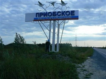
- Explored in 1982.
- Start of operation: 1988.
- Location: Khanty-Mansi Autonomous Okrug, Khanty-Mansiysk.
- Geological reserves: 5,000,000,000 tons.
- Recoverable reserves: 2,400,000,000 tons.
- Production method: hydraulic fracturing technologies, water drilling.
The field belongs to the West Siberian oil and gas basin. More than 80% of it is located in the floodplain of the Ob River. Already extracted about 1,350,000,000 tons of hydrocarbons. The development is carried out by the companies Rosneft and Gazprom Neft.
Lyantorskoe
It is considered one of the most difficult Russian deposits to develop. Belongs to the West Siberian oil and gas province.
- Explored in 1965.
- Start of operation: 1978.
- Location: Khanty-Mansi Autonomous Okrug, Surgut District, Lyantor.
- Recoverable reserves: 380,000,000 tons.
- Production method: nine-point reverse development system, flowing well operation.
The main operator of the field is OJSC “Surgutneftegas”.
Fedorovskoe
Belongs to the Surgut arch, the southeastern part of the Chernorechensky uplift. Included in the class of giant deposits.
- Opening: 1971.
- Start of operation: 1971
- Location: Khanty-Mansi Autonomous Okrug, Surgut.
- Geological reserves: 2,000,000,000 tons.
- Recoverable reserves: 189.9 million tons.
- Production method: horizontal drilling, hydraulic fracturing, physicochemical treatment of the bottomhole zone, etc.
It is the backbone of the resource base of Surgutneftegaz. Since its commissioning, the field has produced over 571,000,000 tons of oil.
Mamontovskoe
Belongs to the class of large. Hydrocarbon deposits are located at a depth of approximately 2 - 2.5 km. 
- Explored in 1965. Expedition leader - I.G. Shapovalov.
- Start of operation: 1970.
- Location: Khanty-Mansi Autonomous Okrug, Pyt-Yakh.
- Geological reserves: 1 400 000 000 tons.
- Recoverable reserves: 93,400,000 tons.
The deposit is complex in terms of its geological structure. Since the beginning of operation, 561,000,000 tons of oil have been pumped out. Development is currently being carried out by Rosneft.
A large amount of oil is spilled during its transportation, read the link, what environmental problems arise in this regard in the Sea of Azov
Exploration continues
There are promising places in our country where production can reach large volumes.
In 2013, the Velikoye field was discovered. According to initial estimates, the geological reserves of oil in it are close to 300,000,000 tons. There is still no exact information on how much of this volume of hydrocarbons is recoverable.
Velikoe is one of the largest oil fields discovered onshore in recent decades. The license for its development was obtained by the AFB company. It is likely to attract other operators as partners.
In 2015, it is planned to start the development of the Bazhenov formation - this is the largest
Manifestations and commercial deposits of oil and gas are known in the rocks of the basements and basal horizons of sedimentary basins in the USA, Venezuela, Libya, Morocco, Egypt, Austria, Yugoslavia, Hungary, the CIS countries, China and in the bowels of other states.
The foundations of the tectonotypes of platform areas, marginal and mobile systems are characterized by rock complexes of different composition and age. Hydrocarbon accumulations are found in gneisses, shales, quartzites and other metamorphites, volcanogenic formations and, of course, in granitoids and their weathering crusts. It is estimated that about 40% of the number of deposits discovered in the basement rocks are confined to the latter, and if we take into account their volume, more than 3/4 of the hydrocarbon reserves in the basements of oil and gas geological objects are associated with granitoids.
When the issues of oil and gas content of basement rocks, accompanying weathering crusts and basal horizons of the cover are considered, usually the main attention is focused on the role of fault zones in the formation of reservoirs and hydrocarbon deposits. Examples are given of oil and gas fields of different structure, oil and bitumen manifestations, and flammable gas outlets in one way or another confined to systems of deep disturbances that naturally divide the earth's crust into blocks of different sizes. In the modern geological structure of the planet, some of these blocks are devoid of sedimentary cover and on the day's surface appear in the form of shields and massifs composed of complexes of crystalline rocks, the other part of the blocks is overlain by sediments of different compositions, the thickness of which varies depending on the conditions of their development and hypsometric position, and on the day surface is manifested in the form of tectonic elements of various scales and morphology.
Active hydrothermal and degassing processes occur in fault zones not only of continents, but also in rift systems of mid-oceanic ridges, most often devoid of sedimentary layers.
Thus, the zones of deep faults, especially updated by modern movements, are the “circulatory system” through which fluid and heat exchange occurs in the earth's crust, contributing to the generation of hydrocarbons and their subsequent ontogenesis. The processes of formation of oil and gas accumulation zones, reservoirs and deposits of oil and gas, as well as the spatial distribution of the latter, are largely associated with the faults.
THEM. Shakhnovsky, considering the conditions for the oil and gas content of the basement rocks, notes that in the basement blocks covered by the sediments of the cover, the oil and gas content is most often confined to the weathering crust, the thickness of which reaches 50-80 m, but usually does not exceed 10-15 m. The secondary reservoirs formed here are characterized by complex bizarre outlines and sharp variability of properties in space. Reservoirs forming in fault zones are characterized by a linear shape. Accordingly, the reservoirs in the weathering crusts are subdivided into areal, linear, and mixed types. The author gives characteristics of oil and gas deposits in weathering crusts of different composition, thickness and depth of young and ancient basements. These are deposits discovered in Central Texas, USA (Orff, etc.), Venezuela (La Paz, Mara), Algeria (Hassi Messaoud), Kazakhstan (Oimashi) and others.
K.E. Veselov and I.N. Mikhailov cites statistical data on oil and gas fields discovered in basement rocks in Australia, the Pacific Islands, Asia, Africa, Europe, America. Usually there is a planned correspondence of oil and gas areas in the basement and in the sedimentary cover; rarely, HC accumulations are found only in the basement. Attention is focused on the theoretical aspects of prospecting for oil and gas deposits at great depths in the basement rocks (there are developed, constantly updated, horizontal and vertical fracture systems in the basement, which within the platforms reflect their complex multi-order fault-fracture-block structure). The formation of the latter is explained in terms of tectonics of global rifting. This concept harmoniously combines fixist and mobilist ideas about tectogenesis, which make it possible to reasonably consider the development of the earth's crust and the formation of its fracture-block divisibility. Particular attention is paid to cracking. Depending on the scale of its manifestation, fracture systems can connect not only different horizons of the sedimentary cover, but also penetrate deep into the basement rocks, facilitate the migration of fluids and the formation of hydrocarbon deposits in the geological environment, which was traditionally considered unpromising. The fractured-block structure of the crust leads to the fact that, depending on the location, the same rocks can be both monolithic-impermeable and good secondary reservoirs, the porosity of which is determined by fracturing and the action of various physicochemical processes. The oil and gas deposits known in the basement rocks are not accidental (although the vast majority of them were discovered by chance!), But a manifestation of a certain regularity, which makes it possible to assume huge accumulations of hydrocarbons at great depths. The main objects of search should be fracture-fault-block structures of the continental crust, which should have large vertical and limited horizontal dimensions. Fracturing in hard rocks and at great depths is a widespread geological process that contributes to oil and gas accumulation.
V.L. Shuster provides information (composition of rocks, reserves and well rates, thickness of the oil-saturated part of the section, reservoir properties) about some oil and gas fields discovered in crystalline rocks in Libya, Egypt, India, Brazil, Venezuela, the USA and Kazakhstan. Deposits, as a rule, are multilayer, deposits are partially or completely lithologically and (or) tectonically screened, located in normally sedimentary rocks and in fractured gneisses, granites, granodiorites, granophyres, and porphyrites of foundations of different ages. The rock complexes of the foundations of the West Siberian plate, the Siberian platform, on the territory of the Arctic and northeastern seas, the Far East can be new promising targets for prospecting for oil and gas deposits.
The formation of HC accumulations within the basement is due to the interaction of two counter flows: deep vapors, gases and heat, tending from below from the bowels of the earth and cooled organic mineral matter, descending from above into the bowels. The migration of fluids and the occurrence of thermobaric conditions for the formation of hydrocarbons is facilitated by the permeability zones associated with deep faults. Faults also control the formation of various structures and associated traps, the transformation of dense granitoids into fractured ones, and the spread of reservoirs and seals. These requirements meet the conditions of oil and gas accumulation both in the crystalline rocks of the basement and in the sediments of the cover. The genesis of hydrocarbons for the industrial use of oil and gas is not essential.
Oil fields associated with reservoirs in granitoids are known in Russia, Kazakhstan, Libya, China, India, USA, Canada. The overwhelming majority of them are confined to low-thickness weathering zones.
Against this background, the structure and oil-bearing conditions of the White Tiger field located in the Mekong (Kyulong) depression on the shelf of South Vietnam are indicative. At the field, the Cenozoic sedimentary cover was initially considered productive, in which the sandstones of the Lower Oligocene and Lower Miocene are oil-bearing, until in 1988 a unique oil reservoir was discovered in the “fresh” Mesozoic granitoids of the basement. Up to 70% of the initial geological reserves of categories С 1 + С 2 are concentrated here. The volume of oil-saturated granitoids is exceptional - the reservoir height is over 1300 m and the values of the filtration properties of the rocks are high, which makes it possible to obtain from them more than 90% of the total oil production. And this despite the fact that wells drilled to depths of more than 5000 m, the OWC (in the generally accepted interpretation) has not been established!
The structure of the White Tigr deposit is a horst-like uplift, blocks of different sizes formed during the period of activation of Paleogene movements along the northeastern strike-slip faults. Their amplitude on the surface of the basement is 1500-1600 m and more, in the cover it decreases and in the sediments of the Upper Oligocene no longer exceeds 400-500 m; displacements along other faults rarely reach 150-200 m. Along the basement top, the uplift is clearly divided into three main parts of the block, represented by the Southern, Central (most elevated) and Northern arches, which, in turn, are characterized by more fractional divisibility. The dimension of the uplift: length - several tens of kilometers, width and height - more than 1.5 km, elevation of the castle - 4650 m (Fig. 51).
Rice. 51. Location of the main fields on the shelf of South Vietnam and
structural-tectonic diagram of the basement surface of the White Tiger deposit
1 - boundaries of tectonic structures; 2 - deposits; 3 - main faults; 4 - isohypses of the basement surface, km; 5 - wells. Deposits: BT - White Tiger, DKh - Dayhung, DR - Dragon, TD - Tamdao.
The thickness of the Cenozoic cover varies from 3000 m in uplifted blocks and up to 8000 m within submerged blocks. The foundation is composed of granites, granodiorites, quartz diorites; mono-breed coefficients of blocks - 0.73; 0.57 and 0.8. Dikes and lava sheets (diabases, basalts, etc.) over the basement are characteristic.
Capacitive and filtration properties are due to the secondary voidness of fractured, cavity-fractured and block types; the inflow of fluid is most strongly influenced by the fracturing of rocks.
The oil reservoir is “broken” into blocks of the basement at different hypsometric levels and is screened by Upper and Lower Oligocene clay-mudstone rocks with a thickness of 5-20 to 40-60 m, in areas where the seal is thin, oil inflows are usually small or absent. Here, it is possible that hydrocarbons flow from the basement rocks to the deposits of the Lower Oligocene. The maximum depth of proven oil saturation is 4350 m, the estimated depth is 4650 m.
The oil-bearing capacity of the basement rocks has also been established on other structures of the Mekong depression - the Dragon, Tamdao, Baden, Bivi blocks; large reserves are predicted at the Daihung field in the South Konshon depression.
O.A. Shnip, having considered the conditions of oil and gas content of the foundations, proposes geological criteria for assessing the prospects of foundation rocks for oil and gas:
1. Granitoids are the most probable group of basement rocks capable of accumulating and preserving industrial accumulations of hydrocarbons.
2. The paths of fluid migration are associated with fractured zones and with other systems of void space that may arise in the basement.
3. Reservoirs in the basement are formed under the influence of rupture tectonics and hypergene influences, which contribute to the formation of void space in any rocks.
4. The seals of oil and gas deposits in the basement are the horizons of impermeable rocks of the sedimentary cover. Impermeable basement rocks can also be insulating complexes.
5. The confinement of industrial accumulations of oil and gas to the foundations of sedimentary basins.
6. Placement of hydrocarbon accumulations in the basement protrusions, rising above its roof by ten, hundreds or more meters.
7. Hydrocarbon inclusions in granitoids minerals.
8. Depths of basement rocks from 3.5 to 4.3 km.
9. The presence of zones of oil and gas formation at a distance accessible for hydrocarbon migration.
V.L. Shuster, Yu.G. Takaev, having characterized the structure of oil and gas fields in the crystalline formations of America, Africa, Europe, Australia, Asia, China, Indonesia and Vietnam, also dwell on the problem of criteria for assessing oil and gas content. Referring to well-known authors who have long been dealing with the oil and gas content of basement rocks and ancient strata. (E.R. Alieva et al., 1987; E.V. Kucheruk, 1991; B.P. Kabyshev, 1991; R. Sheriff, 1980, 1987; and others), they indicate the following indicators of basement oil and gas content:
Occurrence of hydrocarbon accumulations in basements below regional unconformity surfaces;
Sharp dissection of the basement relief;
The depth of occurrence or location of HC accumulations in the basement cannot exceed the depth of the base of the sedimentary layer in the basins' depressions;
Structural factor (the most promising are the shafts and ledges of the foundation), incl. the presence of fault zones;
Hydrogeological conditions for the preservation of oil and gas accumulations;
The presence of voids in crystalline rocks.
Analysis of the proposed criteria and indicators for assessing the oil and gas content of basement rocks of different tectonotypes shows that most of them do not fundamentally differ from the signs and conditions of oil and gas content and a set of tectonic, lithological, hydrogeological and geochemical indicators and criteria for oil and gas accumulation and safety of hydrocarbon deposits, usually used to assess the prospects of sedimentary basins. for oil and gas. And in the foundation, and in the cover, ultimately, the main thing is the collector and the tire! In the formation of hydrocarbon traps, the most important role is played by fault-block structures, which have determined the erosion-tectonic relief and regional unconformity surfaces. And, in addition, fault-block (interblock!) Systems undoubtedly control the placement of the lion's share of oil and gas fields in the earth's crust.
The tectonic factor in the totality of processes that determine the geological environment and its oil and gas content is the leading one. It is tectogenesis that determines the development of sedimentary oil and gas basins, different in scale, structure and age, and their zonal distribution in the earth's crust. Its role is manifested at all levels of forecasting and prospecting for oil and gas fields. In this case, the tectonic regime, forming the (layered) block structure of the basin, controls the formation and distribution of hydrocarbons in the section and over the area of the territory. The intensity and direction of structure-forming movements directly or indirectly affect the setting and scale of sedimentation, the degree of rock change, the type and nature of OM transformation, the areas of recharge and discharge of formation waters, the time variation of the geothermal gradient, regional directions of fluid flow and other processes accompanying or determining oil and gas content.
The fact of block control over the formation and distribution of many minerals has been established. It is quite obvious that deep disturbances, which form the basis of interblock (boundary) systems, are zones of movable junction of the blocks separated by them and determine their certain autonomy and specificity of oil and gas content.
As a rule, block and interblock systems are more contrasting in the structure of the basement and the lower part of the sedimentary cover than in its upper one. On the day surface, they are often reflected by folded (plicative) structural forms (swells, troughs, etc.), often controlled by consedimentation faults.
In this sense, indicative, for example, is the structure of the eastern part of the Russian Platform, where regionally extended consedimentation graben-like troughs are identified in Bashkortostan, which control linearly expressed zones of oil and gas accumulation (EV Lozin, 1994) (Fig. 52).

Rice. 52. Map of isopachs of the Kynovo-Pashi stratum of sediments
1 - isopachs, m; 2 - western border of the folded Urals; 3,4 - boundaries of wedging out: Pashi (3) and Kynovsk (4) deposits; 5,6- disjunctive zones (GP): established, assumed; 7 - administrative border
The geochronological sequence and connection of the mechanism of the formation of graben-like troughs with the ancient rift structure of the Riphean-Vendian are traced, and the structural prerequisites for the formation of possible zones of oil and gas accumulation, caused by block movements, are indicated. These preconditions may well be applicable to other platforms, where oil and gas potential of ancient strata is assumed (Fig. 53).

Rice. 53, Structural-tectonic scheme of the Eifelian-Early Frasnian sub-level
The problem of the oil and gas content of the ancient strata of the East European (Russian) platform is associated with the structural-tectonic conditions, the stratigraphy of the Vendian-Cambrian rock complex, which is more studied than the Riphean deposits, and signs of oil and gas content (inflows of Precambrian oils obtained in the wells of the Danilovskaya area in the central part of the Moscow syneclise, on the territory of Udmurtia, Bashkortostan, Kirov and Perm regions - areas Ocher, Siva, Sokolovskaya, etc.), oil source rocks (oil source potential and the time of its realization; black mudstones - “Vendian domanik” and dark-colored clays enriched with bitumoids, Moscow syneclise), collectors and seals (respectively, sandy and clayey members of the Vendian-Cambrian complex in the Moscow and Mezen syneclises; the most regionally sustained cap is clay deposits of the Redkinskaya (Ust-Pinezhskaya) suite), traps (structural and lithological differentiation of ancient strata suggests the formation of a catch nis of different types). The tectonotype of the traps associated with the block structure of the Kama-Belsky, Central Russian, Moscow and other aulacogens can be traps of the Yurubcheno-Tokhomskaya oil and gas accumulation zone in the Riphean and Vendian sediments of the Siberian platform. Analysis of the prerequisites for the oil and gas content of the ancient strata of the East European (Russian) platform indicates the presence of all criteria of probable productivity inherent in oil and gas basins; it is only important to find the zones of their favorable combination.
Timan-Pechora OGP is characterized in terms of the alternation of stationed mobile zones and relatively simply built stable regions. The structures of the sedimentary cover repeat up the section in a smoothed form the main features of the structure of the basement, dissected into blocks by deep faults. Different configurations, sizes and orientations of the raised and associated lowered blocks determined the block-block structure in the stable regions and the linear-block structure in the mobile zones. Stable geoblocks are mostly oil-bearing, mobile - gas-bearing (Fig. 54)].

Fig. 54. Timan-Pechora oil and gas province.
1-4 - boundaries of structures: 1 - largest, 2 - large, 3 - medium, 4 - large structures.
A - Timan Ridge: I - East Timan Megaval, II - Tsilemsko-Chetlas Megaval, III - Kanino-North Timan Megaval. B - Pechora syneclise: IV - Omra-Luzskaya saddle, V - Izhma depression, VI - Neritskaya monocline, VII - Malozemel'sko-Kolguevskaya monocline, VIII - Pechora-Kozhvinsky mega-shaft, IX - Denisovsky trough, X - Kolvinsky megaval, XII - Lodminskaya saddle , XIII - Varandey-Adzvinskaya structural zone. B - Pre-Ural foredeep: XIV - Polyudovskoe uplift, XV - Upper Pechora depression, XVI - Middle Pechora uplift, XVII - Bolshesyninskaya depression, XVIII - Chernyshev uplift, XIX - Kosyu-Rogovskaya depression, XX - Chernov uplift, XXI - Korotaikha depression, XXII - Paykhoi uplift. D - Ural ridge.
Undoubtedly, the tectonic activity of the blocks affects their oil and gas content. And this, of course, is due to two main types of indicators, the groups of signs of which characterize both the structure of the blocks themselves and the cover sediments overlying them, in which oil and gas objects are located - oil and gas fields of various scales.
More than half (56%) of the identified fields and deposits (65%) are confined to tectonically active mobile blocks. A significant part of large and largest deposits in terms of geological reserves is associated with them. Most of the potential hydrocarbon resources: up to 70% of oil, about 90% of gas - are concentrated within mobile geoblocks, where the concentration is on average 3-3.5 times higher than in stable ones.
Mobile megablocks are characterized by a set of common features of oil and gas content, although a detailed comparison of them with each other shows certain deviations. An illustrative example is the Cis-Ural megablock, which is characterized by the anomalous structure of the earth's crust. More than half of the predicted gas resources of the NGP are concentrated in the sedimentary cover overlying the megablock. This value may be due to the comparative youth of high-intensity traps and deposits confined to them, which, in turn, is explained by the peculiar geodynamic regime of the megablock in the final stages of the development of the Timan-Pechora basin.
In the Timan-Pechora basins, the boundaries of the ONGO in the stratigraphic range of the Lower Silurian - Lower Permian and (or) a sharp change in their productivity as a whole also coincide with the boundaries of large long-lived blocks of the earth's crust. At the same time, the highest productivity characterizes the blocks that have experienced long-term stable subsidence in geological history - regardless of their subsequent inversion - the Cis-Ural trough, the Pechora-Kolvinsky aulacogen, the Varandey-Adz'va zone (in the latter, the productivity of the ONGO is somewhat lower due to less consistent, less stable subsidence, sometimes followed by a rise). The placement of ZNGN in the basin is also mainly subordinate to two directions that limit the main blocks: sub-Timan and sub-Ural; at the same time, ZNGN, as a rule, correspond either to the largest linear blocks that have undergone a partial inversion after a long immersion (Kolvinsky mega-wall, Laysky swell and others), or to the boundaries of large linear blocks (Shapkino-Yuryakhsky swell, Sorokin swell and others).
As a result of the analysis of the distribution of predicted oil and gas resources, correlations were established between the structure of the blocks of the consolidated earth's crust and the structure of the overlying sedimentary cover formations. When predicting oil and gas content at the regional, zonal and, partially, at the local levels, not only the structure of the sedimentary body itself, which composes the oil and gas basin and its individual parts, should be taken into account, but also the entire thickness of the earth's crust and the processes occurring in it, which to one degree or another affect the character the oil and gas content of the sedimentary shell and the stages of HC ontogenesis occurring in it.
In the Caspian Basin, at all stages of its development, discrete differentiated movements of basement blocks are traced, reflected in the sedimentary cover. The inheritance of the ancient structural plan is proved by drilling on such uplifts as Tengiz and Karachaganak, confined to the raised blocks of the basement. Tectonically screened traps of various types, as well as over-fault and near-fault local uplifts, can be confined to the boundary zones of the blocks of the depression.
Generalization of the materials accumulated by Ukrainian geologists as a result of prospecting for oil and gas in the Dnieper-Donetsk depression, the Black Sea region, Crimea, Volyno-Podolia and other regions of Ukraine, allowed them to characterize the role of fault tectonics in the formation of oil and gas provinces (OGP) and regions (OGO), location zones of oil and gas accumulation and hydrocarbon fields. The influence of the block component of the basin structure is reflected in its oil and gas geological zoning (Fig. 56).
Interest in the oil and gas content of the crystalline basement, and, accordingly, in its block structure, has significantly increased in connection with the discovery “... first in the area of the Akhtyrsky oil field in the Sumy region (well. wells discovered industrial accumulations of oil and gas, concentrated directly in the upper parts of the crystalline basement at a depth of more than 250 m from its surface. " Remarkable is the conclusion about the areas of the Dnieper-Donetsk depression, the most favorable for the concentration of oil and gas, gravitating to the zones of long-lived regional faults, mainly in the northwestern (305 0 -315 0) and northeastern (35 0 -45 0) directions and to nodes of their intersections.

Rice. 55. Scheme of the oil-geological zoning of the northern side of the DDA along the sedimentary cover and the upper fractured zone of the basement rocks (according to II Chebanenko, VG Demyanchuk, VV Krot and others (according to data with simplifications by the author)).
1 - border of the Dnieper-Donetsk oil-and-gas region along the sedimentary cover (along the isohypse - 1 km along the basement surface); 2 - northern marginal violation; 3 - tectonic faults (a - major in the basement rocks, 6 - minor); fields: 4 - oil, 5 - oil and gas, 6 - gas, 7 - parametric Sotnikovskaya well. 499.
Analysis of the DSS data for the West Siberian Plate and the degree of crustal consolidation within it makes it possible to identify blocks delimited by deep faults, to reveal their relationship with the upper mantle, to consider the structure of the sedimentary cover and the distribution of oil and gas fields depending on the block type. Most of the deposits are confined to blocks corresponding to the remnants of ancient folded complexes, the minimum number of deposits is located within blocks corresponding to the position of graben rifts and zones of deep tectonic processing. The block structure is most distinctly expressed in the pre-Mesozoic base of the plate. A typical example of a block structure is the Maloichsky Paleozoic ledge located in the Nyurol depression. It consists of blocks of various sizes, separated by faults. The wells that gave inflows and gushers of oil are located in different blocks, mainly the most elevated. Wells drilled directly in the fault zones usually do not produce tributaries. Considering other similar examples, we can conclude that “... faults not only facilitate the penetration of hydrocarbons into reservoir rocks, but can also cause the disassembly of deposits during subsequent tectonic movements”. Generalization of materials on Western Siberia as a whole showed that for the formation of hydrocarbon accumulations in sedimentary deposits of the earth's crust, predominantly long-term “open” deep faults are of importance. “Healed” faults filled with mineral matter could not be pathways for the vertical movement of hydrocarbons.
The block divisibility of the lithosphere is the main controlling factor in the distribution of minerals in the earth's crust. It is also quite probable that the block divisibility of the lithosphere determines the genetic conditions for the formation and formation of mineral and energy minerals.
17. Unconventional types and sources of hydrocarbon raw materials and
problems of their development
The hydrocarbon resources in the bowels are huge, but only a small part of them, attributed to traditional ones, is being studied. Outside of research, prospecting and development, there is a reserve of resources of unconventional hydrocarbon raw materials, in terms of volume 2-3 orders of magnitude higher than the traditional one, but still poorly studied. Thus, the resources of methane in a hydrated state, dispersed only in the bottom sediments of the World Ocean and shelves, are two orders of magnitude (in oil equivalent) higher than the traditional hydrocarbon resources. About 8-10 4 billion tons of oil equivalent NS. methane is contained in the water-dissolved gases of the underground hydrosphere, and only in the zone of hydrocarbon resources accounting - to a depth of 7 km. The volumes of practically explored oil sands resources are huge - up to 800 billion tons of oil equivalent. NS. in some regions of the world - Canada, Venezuela, USA and others.
In contrast to the mobile in the subsoil, the traditional part of the oil and gas resources extracted by modern technologies, unconventional resources are poorly mobile or immobile in the reservoir conditions of the subsoil. To master them, new technologies and technical means are needed that increase the cost of their search, production, transport, processing and disposal. Not all types of unconventional raw materials are now technologically and economically available for industrial development, but in energy-deficient regions, as well as in basins with depleted reserves and developed infrastructure, certain types of unconventional raw materials can become the basis for modern efficient fuel and energy supply.
The main increase in traditional oil and gas reserves in the world, and especially in Russia, is now taking place in areas with extreme conditions of development - the Arctic, shelf areas, geographically unfavorable regions remote from consumers, and more. The costs of their development are so high that, during the transition to new raw material bases, the development of non-traditional reserves of raw materials will be not only inevitable, but also competitive.
The importance of a comprehensive and timely study of unconventional hydrocarbon resources is especially obvious if we consider that more than half of all considered as traditional oil reserves in Russia are represented by their unconventional types and sources. Consequently, the level of oil production in Russia, which is now considered on the basis of the sum of traditional and unconventional reserves, cannot be considered correct, since their significant volumes do not meet the conditions for profitable development.
Any oil and gas province in the course of development approaches the stage of depletion. Timely preparation for the development of additional reserves in the form of unconventional hydrocarbon sources will allow for a long time to maintain the level of production with profitable economic indicators. Currently, the degree of depletion of most of the large developed fields in Russia, generally, exceeds 60% and approximately 43% of the total production is carried out from large fields with a degree of depletion of 60-95%. Modern oil production in Russia is carried out in regions with a high degree of depletion of reserves. The transition to the development of new resource bases in the Arctic and eastern waters requires a reserve of time and excess capital expenditures, for which the Russian economy is currently not ready. At the same time, all oil and gas fields, even with deeply depleted reserves, have significant reserves of unconventional hydrocarbon resources, the rational and timely development of which will allow maintaining the production level. The progress achieved in the world in technologies for the extraction of oil and gas raw materials allows the development of unconventional types and sources of hydrocarbons, with a cost equivalent to the cost of raw materials in the world market.
Research by VNIGRI has shown significant reserves of oil and gas resources in unconventional sources and reservoirs. Their study and development will make it possible to fill that inevitable pause in the provision of oil and then gas production, which will inevitably arise before the commissioning of new resource bases in regions that are extreme in terms of development conditions. In the future, unconventional sources and types of hydrocarbons will become the basis of their raw material base (see "Shale gas"). Currently, the volume of production of unconventional hydrocarbons does not exceed 10% of their global production. It is predicted that by 2060 they will provide more than half of all hydrocarbon production.
Currently, the following types and sources of unconventional hydrocarbon raw materials appear to be of top priority for development:
1. Heavy oils;
2. Combustible "black" shale;
3.Low-permeable productive reservoirs and complex unconventional reservoirs;
Oil is called a flammable oily liquid of red-brown or black color with a specific odor. Oil is one of the most important minerals on Earth, as it produces the most commonly used fuels today. Usually oil is formed together with another, no less important - natural gas... Therefore, very often these two types of minerals are mined in the same place. Oil can be found at a depth of several tens of meters to 6 kilometers, but most often it is located at a depth of 1-3 kilometers. Natural gas is a gas mixture formed during the decomposition of organic matter. It lies in the earth's interior in a gaseous state in the form of separate accumulations, in the form of an oil cap of oil and gas fields, and also in a dissolved state (in oil and in water).
The most famous oil and gas fields in Russia:
Urengoyskoye natural gas field... This is the second largest gas field in the world in terms of reservoir reserves. The volume of gas here exceeds 10 trillion cubic meters. This field is located in the Yamalo-Nenets Autonomous District of the Tyumen Region of Russia, just south of the Arctic Circle. The name of the deposit was given the name of the nearby village of Urengoy. After the start of the development of the field, a whole working town of Novy Urengoy grew up here. The field was discovered in 1966 and gas production began in 1978.

How oil is extracted (photo by Maxim Yurievich Kalinkin)
Tuimazinskoye oil field... This deposit is located in the Republic of Bashkiria, near the city of Tuymazy. The field was discovered back in 1937. Oil-containing layers are located at a depth of 1-1.7 km. Development of the field began in 1944. The Tuimazinskoye field is one of the five largest fields in the world in terms of oil volume. The size of the deposit is 40 by 20 kilometers. Thanks to the latest method, the bulk of the recoverable reserves have been produced in 20 years. Twice as much oil has been withdrawn from the Devonian formations than would have been possible to extract by conventional methods. However, the reserves are so large that production continues to this day.
Nakhodkinskoye gas field. This natural gas field is located in the Bolshekhetskaya Depression in the Yamalo-Nenets Autonomous District. The reserves of the field are estimated at 275.3 billion cubic meters of gas. Although the field was discovered quite a long time ago (in 1974), its development began only in 2004.
Shtokman gas condensate field. One of the largest deposits in the world, discovered in 1988. It is located in the central part of the shelf approximately 600 km northeast of Murmansk. Gas reserves are currently estimated at 3.7 trillion m2 of gas. Gas production has not yet begun here, since the significant depth of occurrence of the mineral and the difficult development conditions require significant costs and high-tech equipment.
Kovykta field(Kovykta). A natural gas field located in the north of the Irkutsk Region, 450 km north-east of Irkutsk. The deposit is located on a high-mountain plateau covered with dark coniferous trees. It dominates in some part of the territory. Moreover, the area is complicated by numerous canyons. The climatic conditions in the area of the field are also quite severe. Natural gas reserves are estimated at 1.9 trillion cubic meters of gas and 115 million tons of liquid gas condensate.
Vankor field oil and gas field. A deposit located in the north of the Krasnoyarsk Territory. Includes the Vankor and North-Vankor sections. The field was discovered in 1991. Oil reserves exceed 260 million tons, and gas reserves - about 90 billion m2. The development of the field should begin in 2008. It is planned to drill 266 wells here, and supply them via the Eastern Oil Pipeline.

Shtokman field
Angaro-Lenskoye gas field... A large natural gas field located in the Irkutsk region. Named by the names of large - and hangars located nearby. The field was discovered at the beginning of the 21st century. Natural gas reserves are estimated at over 1.2 trillion m2.
Samotlor oil field (Samotlor). This is the largest oil field in Russia and one of the world's largest oil fields located in the Khanty-Mansiysk Autonomous Okrug, in the Nizhnevartovsk region near Samotlor. According to experts, oil reserves here amount to 2.7 billion tons. They lie at a depth of 1.6-2.4 km. The field was discovered in 1965. Basically, the deposit was developed in the 80s of the last century. To date, about 2.3 billion tons have already been mined.
Ety-Purovskoye oil field... This is an oil field located in the Yamalo-Nenets Autonomous Okrug, near the city of Noyabrsk. Opened in 1982, development began only in 2003. Oil reserves are about 40 million tons.
Verkh-Tarskoye oil field... Located in the north of the Novosibirsk region. Oil reserves are about 68 million tons. One of the disadvantages of the field is the lack of necessary communications. The oil produced in this field is distinguished by a small amount of impurities. The field was discovered in 1970 and development began in 2000.
Number of deposits oil and gas in Russia much bigger. Some of them, discovered in the last century, have already been developed, while the development of others, relatively recently discovered, has not even begun (for example, the Vankor field). In addition, there is reason to believe that not all deposits in the country have been discovered.
 05 01 medical biochemistry where to work
 Biochemistry who can work
 Types of monopolies: natural, artificial, open, closed